.The Silk Road[] was a network of Asian trade routes active from the second century BCE until the mid-15th century.[] Spanning over 6,400 km (4,000 mi) on land, it played a central role in facilitating economic, cultural, political, and religious interactions between the Eastern and Western worlds.[] The name "Silk Road" was coined in the late 19th century, but some 20th- and 21st-century historians instead prefer the term Silk Routes, on the grounds that it more accurately describes the intricate web of land and sea routes connecting Central, East, South, Southeast, and West Asia as well as East Africa and Southern Europe.[1] In fact, some scholars criticise or even dismiss the idea of silk roads and call for a new definition or alternate term. According to them, the literature using this term has "privileged the sedentary and literate empires at either end of Eurasia" thereby ignoring the contributions of steppe nomads. In addition, the classic definition sidelines civilisations like India and Iran..
.Despite the popular imagination, Silk Road was never a singular east-west trade route that linked China to the Mediterranean, nor was there unrestricted trade before the Mongol Empire. It was a network of routes. Even Marco Polo, often linked to the Silk Road, never used the term despite traveling during a time of Mongol-enabled ease of movement.
The northern route started at Changan (now called Xian), an ancient capital of China that was moved further east during the Later Han to Luoyang. The route was defined around the 1st century BCE when Han Wudi put an end to harassment by nomadic tribes.[29]The southern route or Karakoram route was mainly a single route from China through the Karakoram mountains, where it persists in modern times as the Karakoram Highway, a paved road that connects Pakistan and China.
It then set off westwards, but with southward spurs so travelers could complete the journey by sea from various points. Crossing the high mountains, it passed through northern Pakistan, over the Hindu Kush mountains, and into Afghanistan, rejoining the northern route near Merv, Turkmenistan. From Merv, it followed a nearly straight line west through mountainous northern Iran, Mesopotamia, and the northern tip of the Syrian Desert to the Levant, where Mediterranean trading ships plied regular routes to Italy, while land routes went either north through Anatolia or south to North Africa. Another branch road travelled from Herat through Susa to Charax Spasinu at the head of the Persian Gulf and across to Petra and on to Alexandria and other eastern Mediterranean ports from where ships carried the cargoes to Rome


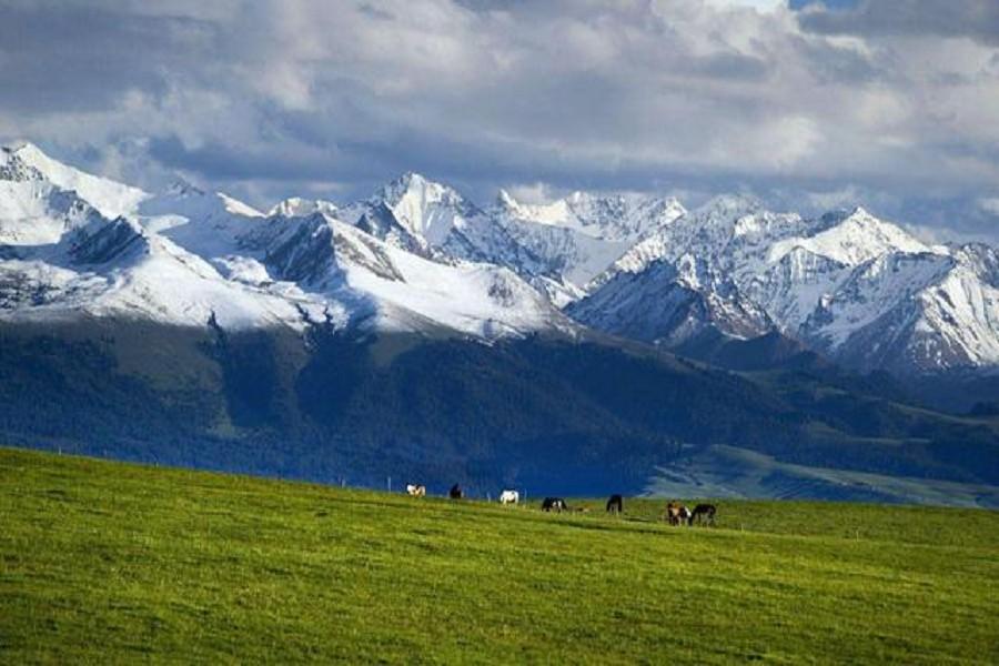
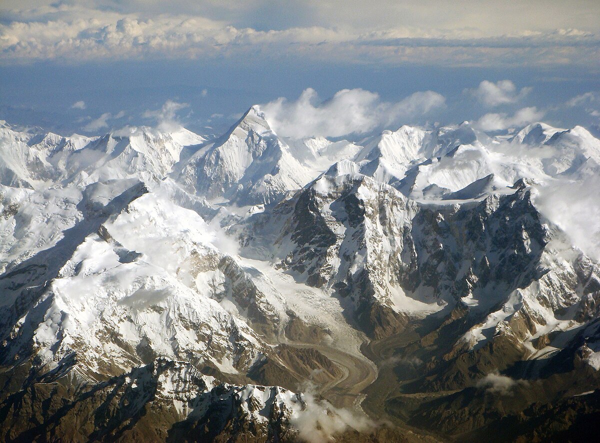
天山與絲綢之路.天山山脈(維吾爾語:تەڭرىتاغ Tengri Tagh/Тәңри тағ;哈薩克語:Тәңіртау/ٴتاڭىرتاۋ;吉爾吉斯語:Ала-Тоо/تەڭىر-توو;東干文:Тянсан,小兒經:تِيًا صًا)古稱敦薨之山[1]。是亞洲中部最大的一條山脈,橫亙中國新疆的中部、吉爾吉斯和烏茲別克,西端伸入哈薩克。古名白山,又名雪山,冬夏有雪,故名,匈奴謂之祁連[2],漢朝稱之爲北山,唐朝時又名折羅漫山。天山山脈長約2500km,寬約250~300km,平均海拔約5000m。最高峰是托木爾峰,海拔為7439m,在中國和吉爾吉斯邊界[3];第二高峰是汗騰格里峰海拔6995m,在中國,哈薩克,吉爾吉斯交界處[4];博格達峰的海拔5445m,在中國境內。前兩者是前蘇聯雪豹登山獎必要五峰之二[5]。中亞的三條大河——錫爾河、楚河和伊犁河都發源於此山。天山山脈把新疆分成兩部分:南邊是塔里木盆地;北邊是準噶爾盆地。天山由東西走向的褶皺斷塊山組成,山間有陷落盆地,如哈密盆地、吐魯番盆地,西部有伊犁谷地。..
絲綢之路,簡稱絲路,指從漢唐古都長安/洛陽]出發,經甘肅、新疆,到中亞、西亞、歐洲,並聯結地中海各國的陸上通道,最遠到達西亞諸國的陸上貿易通道,東漢時班超再次出使西域打通了荒廢已久的絲綢之路,將東端延伸到京師洛陽,西端延伸到歐洲(羅馬)。這條道路也被稱為「陸上絲綢之路」,以區別日後另外兩條冠以「絲綢之路」名稱的交通路線。因為由這條路西運的貨物中以絲綢製品的影響最大,故得此名。其基本走向定於兩漢時期,包括南道、中道、北道三條路線。「絲綢之路」一詞最早來自於德意志帝國地理學家費迪南·馮·李希霍芬男爵於1877年出版的一套五卷本的地圖集。但實際上,絲綢之路並非是一條 「路」,而是一個穿越山川、沙漠和海洋且沒有標識的道路網絡,並且絲綢也只是貨物中的一種。\
廣義的絲綢之路指從上古開始陸續形成的,遍及歐亞大陸甚至包括北非和東非在內的長途商業貿易和文化交流線路的總稱。除了上述的路線之外,還包括約於前5世紀形成的草原絲綢之路、和與中古初年形成的西北絲綢之路,在宋代以後發揮巨大作用的海上絲綢之路開始興盛,但在宋初西北絲綢之路被取代,成為路上交流通道的則是南方絲綢之路。元代開始是古代海上活動最為頻繁、海外貿易最為發達的時期,船運能力猛增。於是,海上絲綢之路的重要性超過了陸上絲綢之路,使歐亞交流達到了空前的程度.


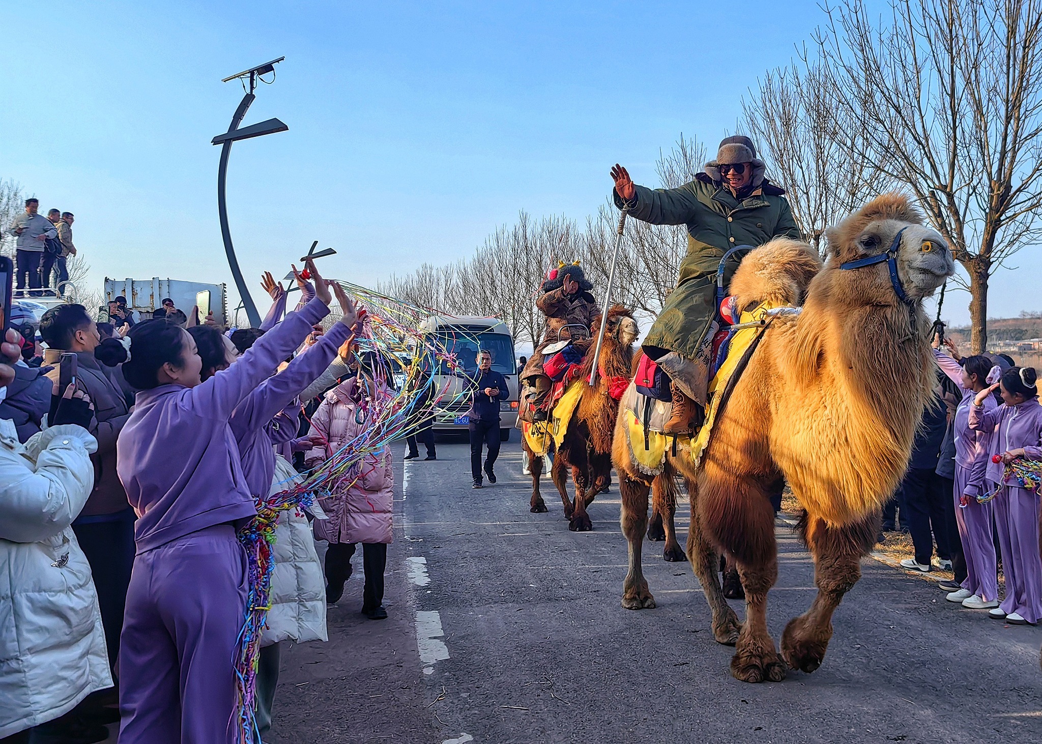

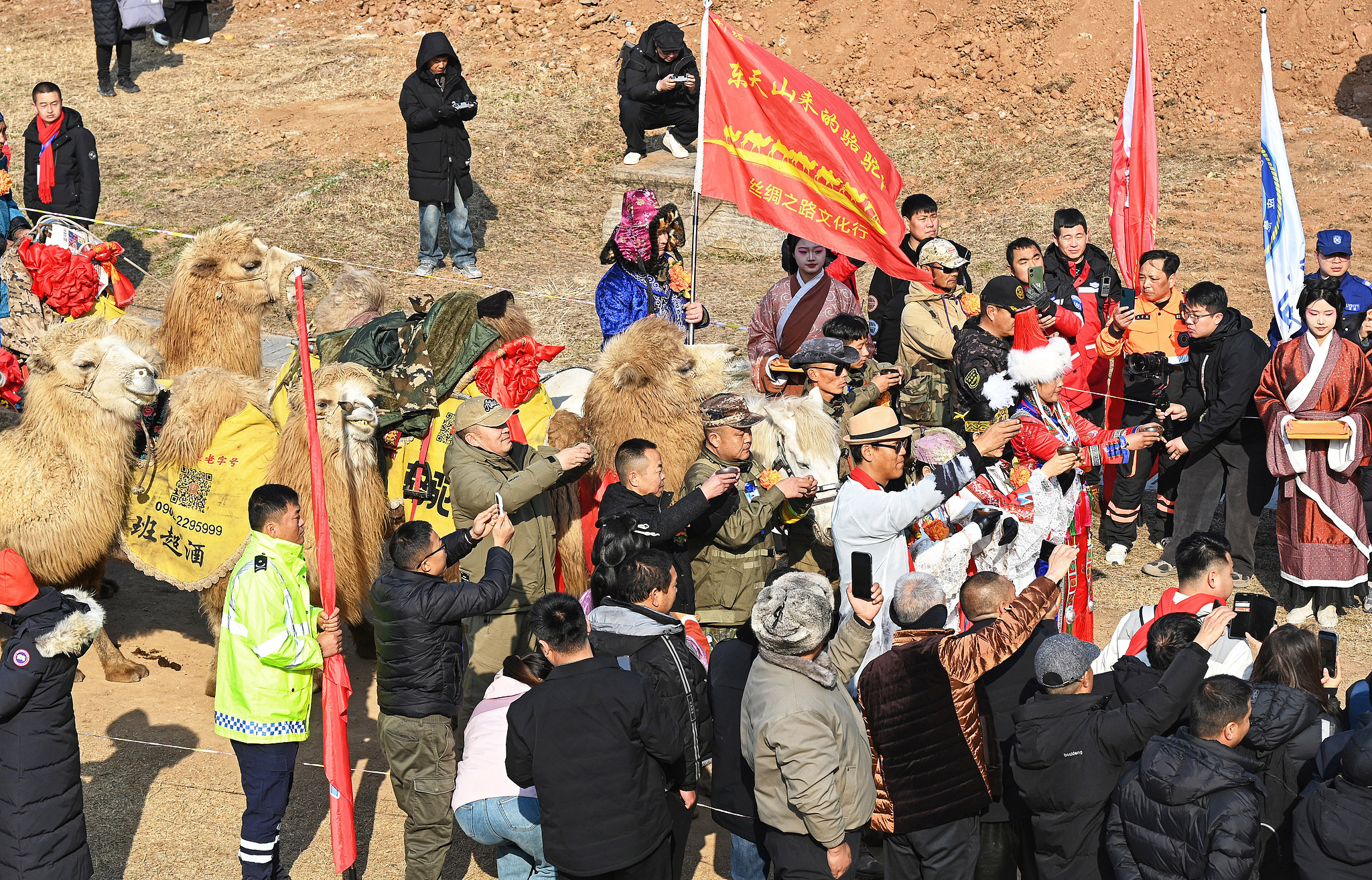
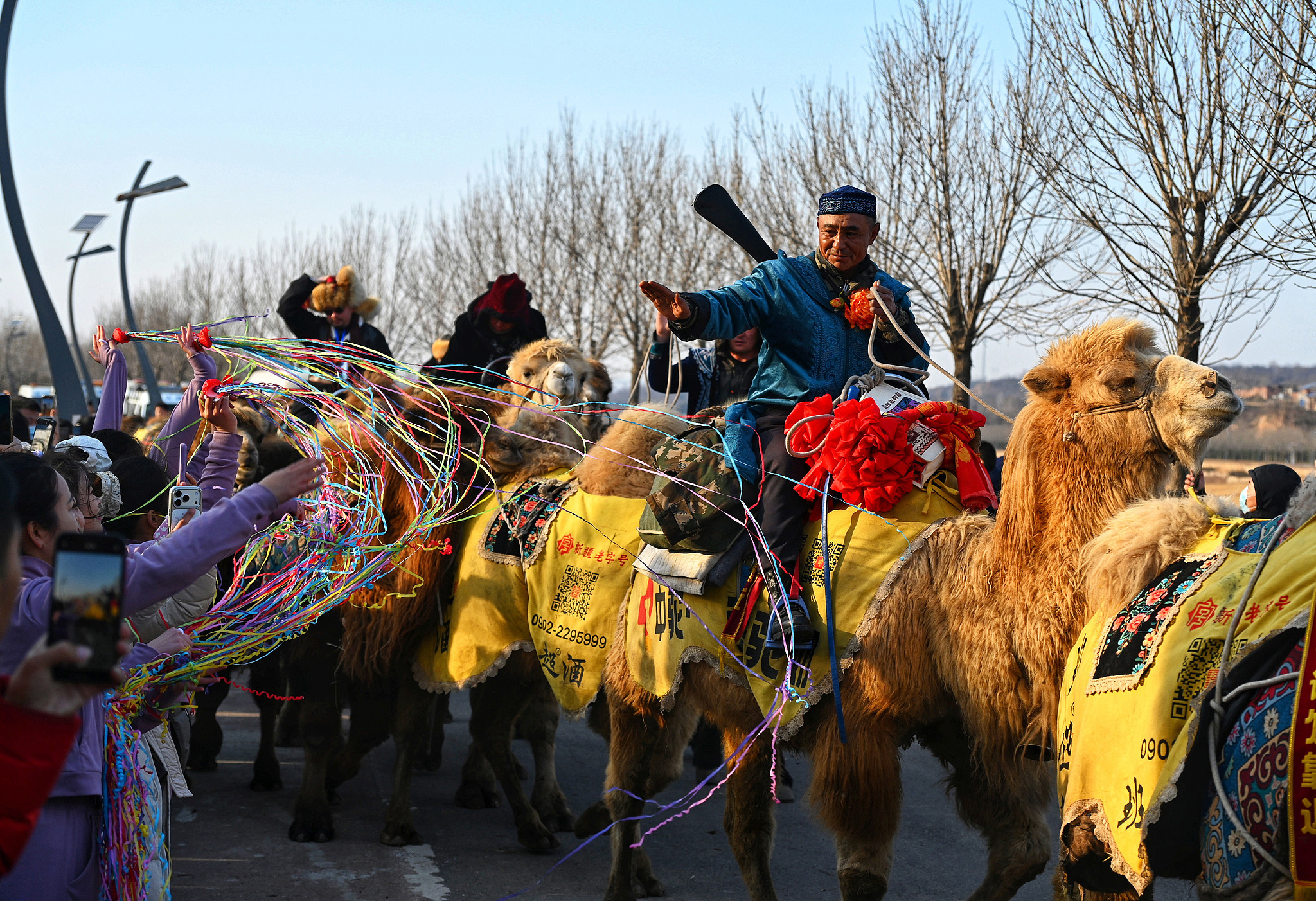

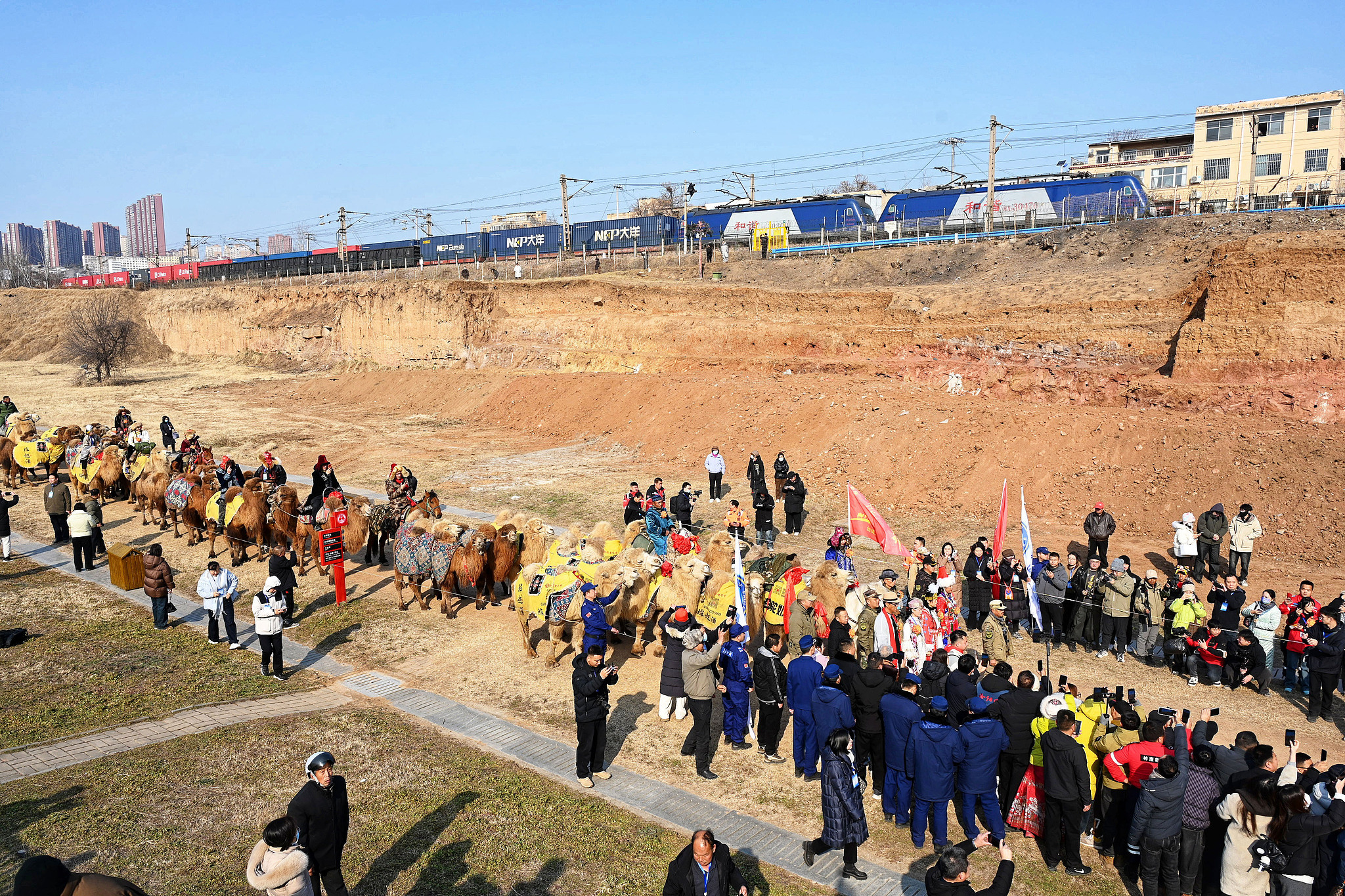
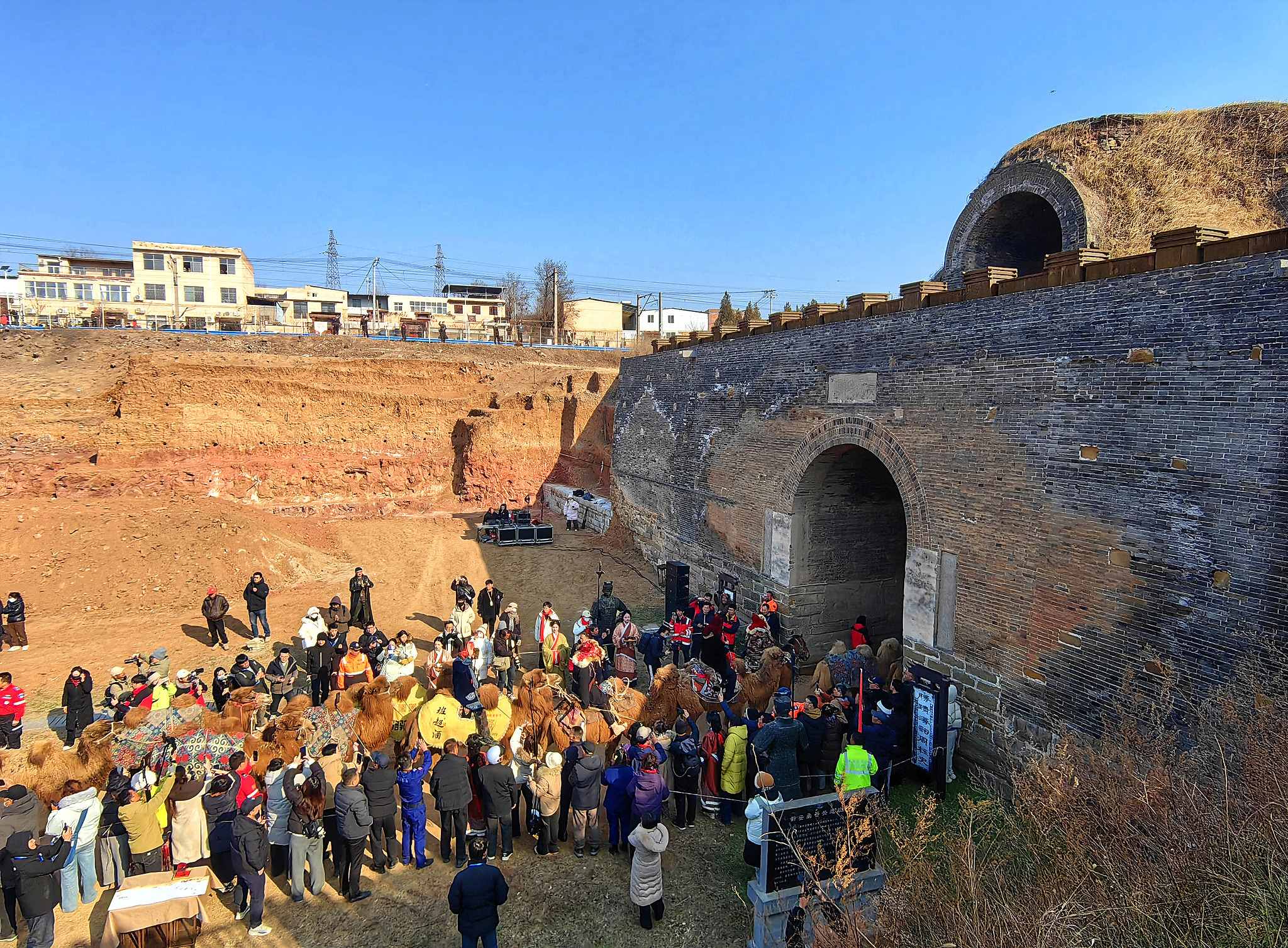
silk road caravan from Barkol in Xinjiangs eastern Tianshan Mountains arrived at Luoyang in Chinas ancient central plains. During the 136-day journey, they passed several famous sites, including the Hangu Pass from the Han Dynasty..


限會員,要發表迴響,請先登入


