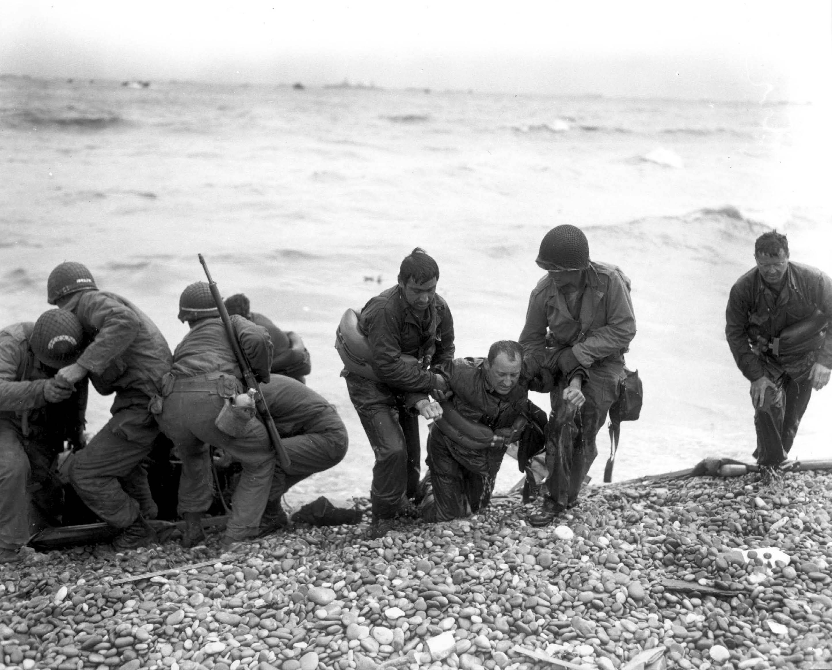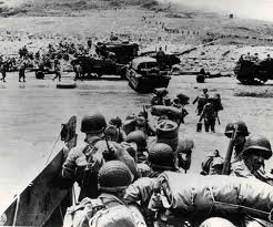
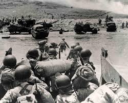

美國陸軍第1師的士兵們搭乘著步兵登陸艇於奧馬哈海灘登陸,登陸艇則是由美國海岸防衛隊駕駛的塞繆爾·蔡斯號步兵登陸艦(APA-26)所送出。此張照片由海岸防衛隊首席攝影師羅伯特·F·薩金特,於1944年6月6日(D-Day)當天跟隨部隊所攝.
奧馬哈海灘(Omaha Beach)是1944年6月6日,第二次世界大戰諾曼第戰役中盟軍四個主要登陸地點之一的代號名稱,盟軍於此日在諾曼第地區著陸,試圖深入歐洲內陸以解放被納粹德國與魁儡政府維琪法國所統治的民眾。
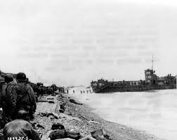
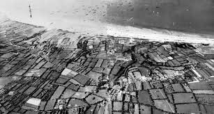
奧馬哈海灘這片位於法國北部海岸,並且直接面對著英吉利海峽的灘頭全長有8公里(約5英里),東起聖奧諾里訥-德佩爾泰,西至濱海維耶維爾才結束。此海灘對盟軍有重要的意義,如果盟軍能夠成功控制這片海灘,那麼登陸於海灘東部黃金海灘的英國登陸部隊,就能與海灘西部猶他海灘的美國登陸部隊會師;這樣的話便可將整個諾曼第前線從零散的灘頭陣地,沿著英吉利海峽整合成一個大型的戰線。在盟軍的作戰計劃中,負責進攻此海灘的是美國陸軍,而美國海軍與英國皇家海軍則負責將登陸部隊送上灘頭。
盟軍計劃派遣兩股部隊,於「D-Day」當天分別進攻此海灘的東西兩部分:進攻海灘東部的是久經戰爭考驗的美國陸軍第1師,而進攻海灘西部的則是從奧克角調過來9個連規模的美國陸軍遊騎兵部隊與之前從未上過戰場的第29步兵師。
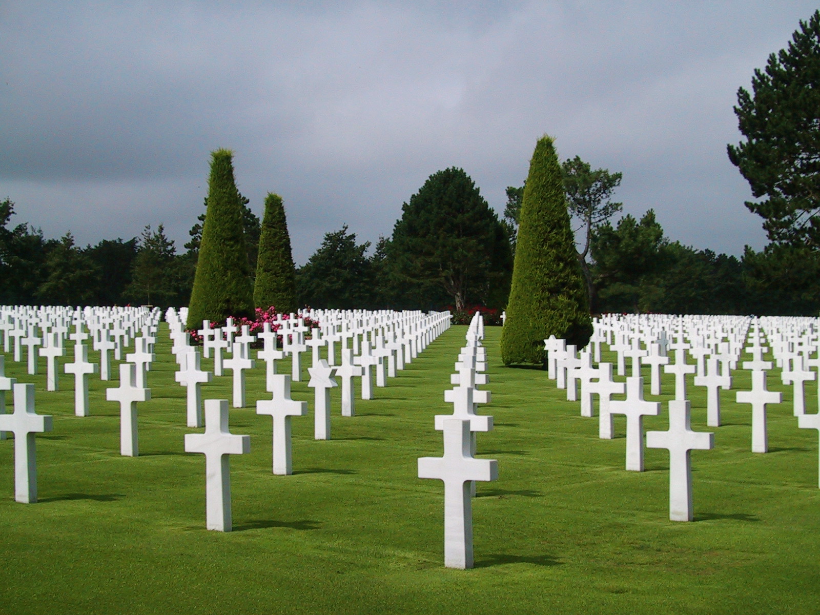
這裡有9300座白色十字架,代表在奧瑪哈沙灘(Omaha Beach)登陸而犧牲的美國軍人。


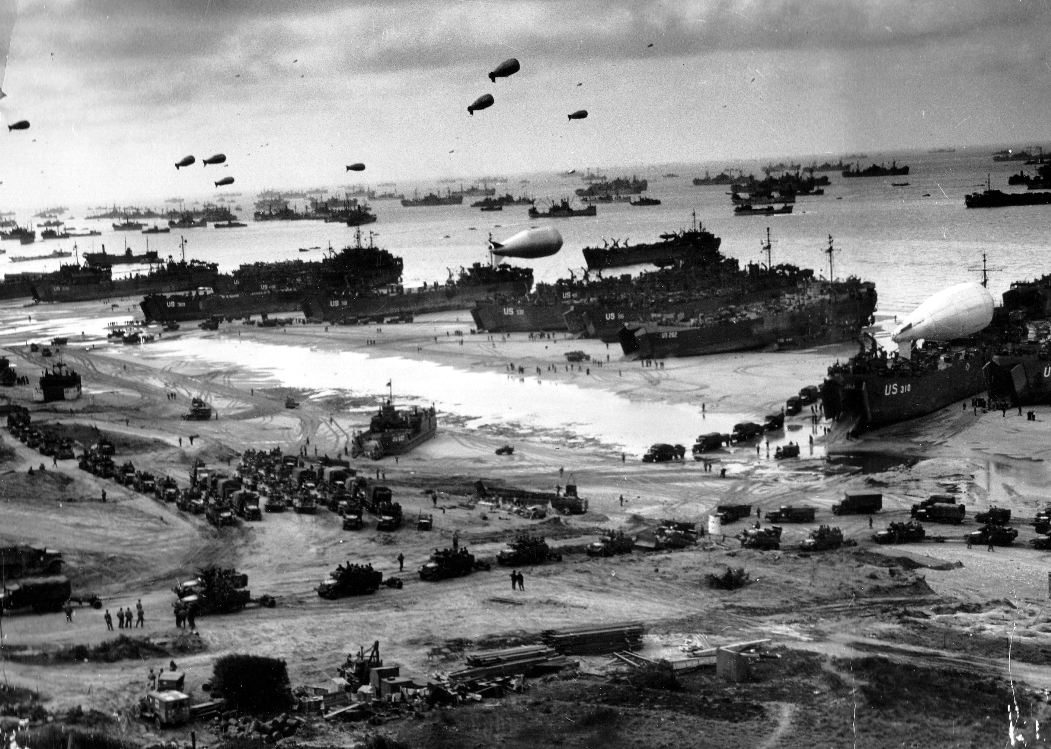
在奧馬哈海灘上的守軍被完全消滅之後,在風暴來臨之前的幾天里,共有11000名士兵,2000輛各式車輛和9000噸貨物通過A碼頭上了岸。]在D日之後的100天內,共有100萬噸補給,10萬輛車輛和60萬名士兵通過奧馬哈海灘登上了歐洲大陸,同時還有93000名傷員從奧馬哈海灘被送回了後方。]今天,奧馬哈海灘上盟軍碼頭殘留下來的部分在低潮時仍然可以看到。扁礫石灘已在D日之後的幾天內被盟軍工程兵清除。海灘公路得到了延伸,附近的村莊也得到了擴大,但海灘的地形仍然沒變,德軍防禦工事的遺迹仍然可以被看到。]在Colleville城附近的一塊懸崖上,盟軍為在諾曼第戰役中陣亡的美軍將士修建了一處墓地。
Omaha Beach, commonly known as Omaha, was the code name for one of the five sectors of the Allied invasion of German-occupied France in the Normandy landings on 6 June 1944, during World War II. Omaha is located on the coast of Normandy, France, facing the English Channel, and is 5 miles (8 km) long, from east of Sainte-Honorine-des-Pertes to west of Vierville-sur-Mer on the right bank of the Douve River estuary. Landings here were necessary in order to link up the British landings to the east at Gold with the American landing to the west at Utah, thus providing a continuous lodgement on the Normandy coast of the Bay of the Seine. Taking Omaha was to be the responsibility of United States Army troops, with sea transport and naval artillery support provided by the U.S. Navy and elements of the British Royal Navy.Today at Omaha jagged remains of the harbor can be seen at low tide. The shingle bank is no longer there, cleared by engineers in the days following D-Day to facilitate the landing of supplies.
The beachfront is more built-up and the beach road extended, villages have grown and merged, but the geography of the beach remains as it was and the remains of the coastal defenses can still be visited. At the top of the bluff overlooking Omaha near Colleville is the American cemetery. As late as 1988, particles of shrapnel, as well as glass and iron beads resulting from munitions explosions, have been found in the sand of the beach.]