賀2020中國北斗衛星導航系統全面運作China's BeiDou system begins its global service
2020/08/0319:10
瀏覽900
迴響0
推薦6
引用0
狂賀,
中國北斗衛星系統全面運作,服務全球人類,
中華科技領先群雄.
The Economic and Military Impact of China’s BeiDou Navigation System
The combination of recent technological developments offers a China-led world order a definitive competitive edge.
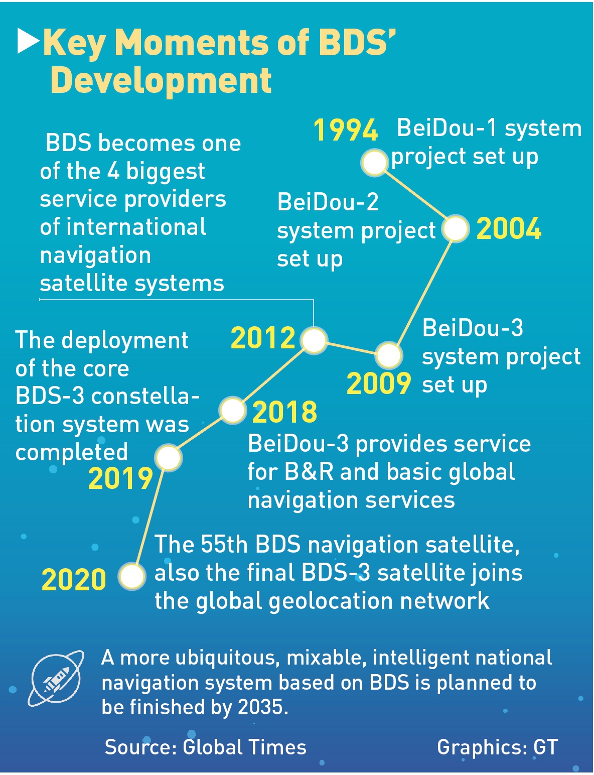
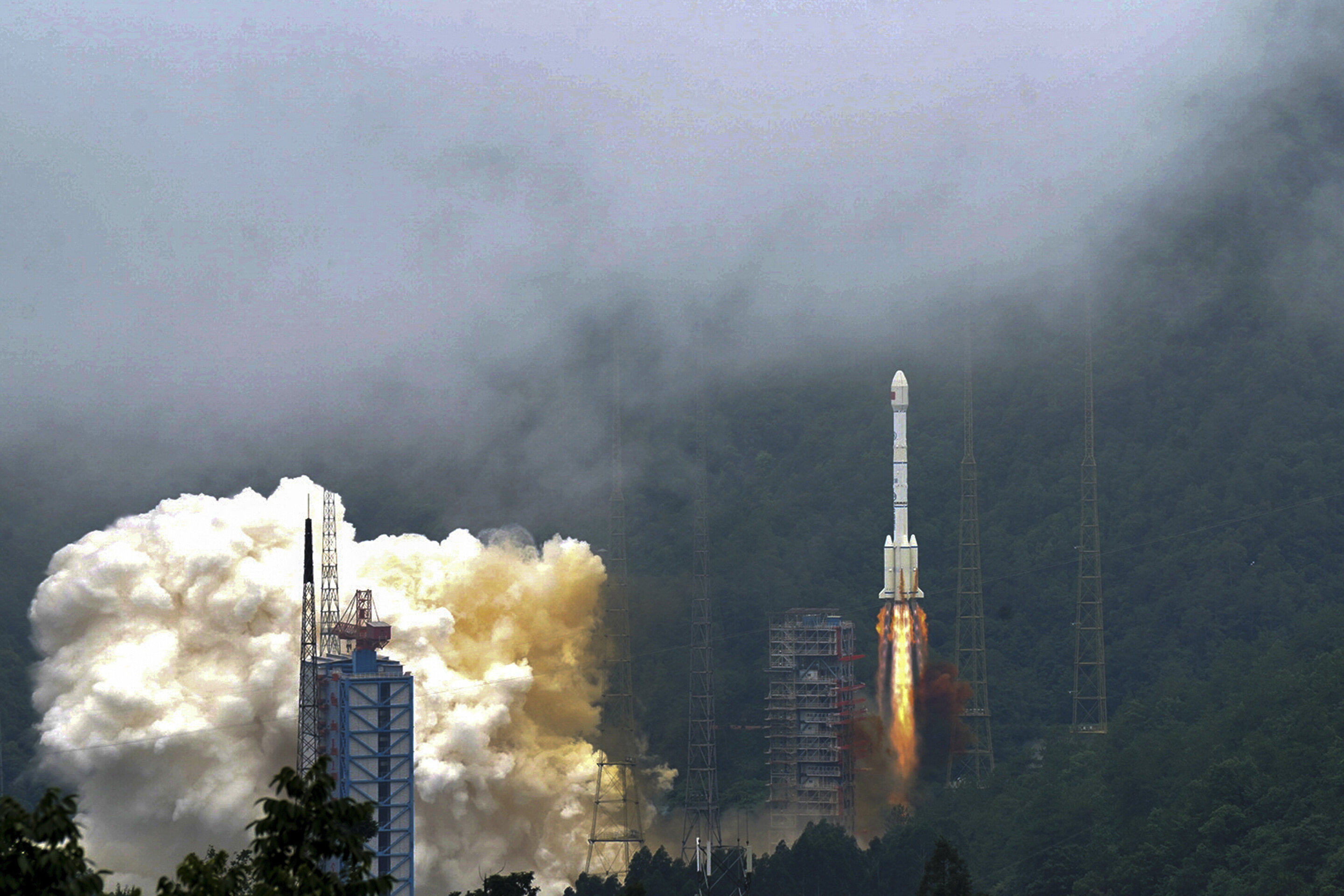
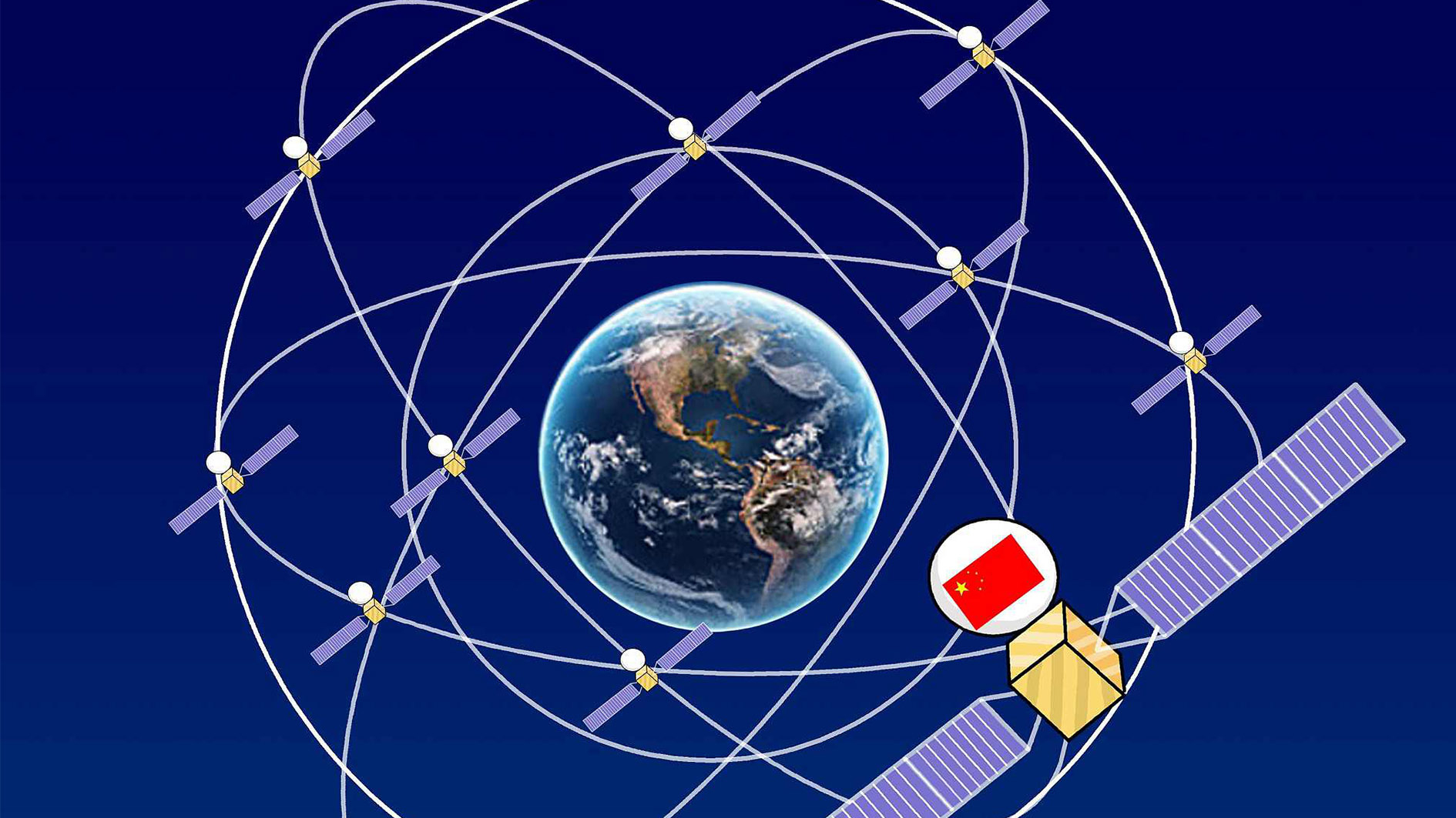
On June 23, 2020, China completed construction of its BeiDou Positioning and Navigation System (BDS) by launching the 55th and final satellite for its BDS3 navigation constellation. With this launch, China now enjoys a fully independent self-reliant global navigation satellite system (GNSS) as an alternative to the U.S. Space Force-maintained Global Positioning System (GPS). An independent BeiDou offers China augmented precision navigation and timing (PNT) for its military space forces.
The BeiDou network, a major infrastructure independently constructed and operated by China, can better meet the demands of the country’s national security, economic as well as social development. It can also provide more stable and reliable services, as well as an alternative to the U.S.-owned Global Positioning System (GPS) [emphasis added] for global users. Given national security concerns due to the GPS’s dominance, China is not the only one in the world that strives to develop its satellite navigation systems. For many years, the European Union, Russia and others have all been working on their own projects.
In 1996, during the Third Taiwan Strait Crisis, China fired three missiles to locations on the Taiwan Strait as a warning signal against Taiwan’s moves for independence and full internationally recognized statehood. While the first missile hit about 18.5 kilometers from Taiwan’s Keelung military base as a warning, China lost track of the other two missiles. China asserts that the United States had cut off the GPS signal to the Pacific, on which China was dependent at that time for missile tracking. /
In 1996, China decided to build its own navigation system, to be completed within 25 years, to establish truly independent military command and control, and precision missile guidance and tracking. The end result of that decision is the establishment of the independent GNSS and PNT systems, the PLA Strategic Support Force, and the development of China’s missile capabilities, to include cruise missiles, ballistic missiles, and hypersonic missiles under the PLA Rocket Force.
北斗星君繞環宇神州聲勢耀全球
分分秒秒真精確中華科技今領先
中國北斗衛星系統,配合5G電信網路使用,將建設中國科技,
邁向高峰,傲視群雄,中國將主導全球5G.的發展與應用.
Economic and Military Implications of BDS:
There are several economic implications of the completion of an independent BeiDou navigation system. First, China promises that the BDS will build a world of intelligent manufacturing and innovation based on a self-sustaining system not dependent on the West. Most importantly, from a geopolitical perspective, BeiDou offers an alternative to GPS, enabling China to further consolidate its hold on global infrastructure and rulemaking to challenge the centrality of the United States to form partnerships and alliances and to control the standards for information technology, mobile devices, 5G, self-driving cars and drones, and the broader internet of things.
China has completed the construction of BeiDou-3 primary system and BeiDou Navigation Satellite System (BDS) and will start providing its global services on Thursday.
The announcement was made by Ran Chengqi, director of China Satellite Navigation Office and BDS spokesperson at a news conference.
"The BeiDou system has expanded its service scope from regional to the whole world," said Ran, and the system "officially will enter a global era."
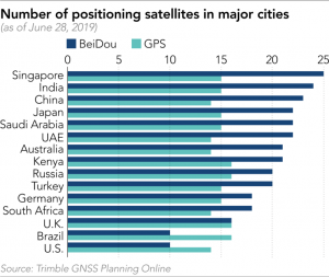
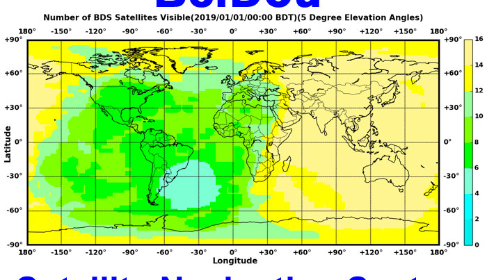
As of June 28, Chinese satellites were observed more frequently than GPS satellites in 130 of 195 countries … More than 20 BeiDou satellites were observed over mainland China.
BeiDou is also making inroads in Japan, the U.S. and Europe. About 10 Chinese satellites were seen over New York and London, fewer than in Asia. But there were almost as many Chinese satellites overhead in the two cities as American and European ones during certain hours.
China Launches Additional Beidou Satellite.
China has successfully launched a further satellite to augment its Beidou satellite navigation system on 17 May. Beidou-2G8 was launched from the Xichang Satellite Launch Centre in Sichuan Province on a Long March -3C/G2 launch vehicle.
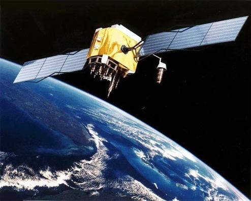
Developed by China to create a completely independent satellite navigation system to aid its security, development and the economy, Beidou provides high accuracy position, navigation and timing data in all weather and at all times of the day and night.
Based upon the DFH-3b bus, the spacecraft inhabit both geostationary and intermediate orbits. The deployment of the GEO satellite to orbit represents the second phase of Beidou’s deployment.
The satellites are based on the DFH-3B Bus and feature a phased array antenna, laser reflector and deployable S, L and C-band antennas.
The deployment of the satellite follows on from previous launches dating back to 2016. China plans to launch between 8 and 10 Beidou satellites this year.